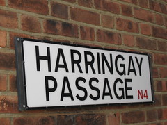
Harringay, Haringey - So Good they Spelt it Twice!
Happy 50th Birthday to the modern postcode!
The UK's country-wide postcode system, introduced to speed up mail deliveries but now used for a range of applications, is half a century old.
The whole of the UK was divided into postal districts for the first time after a trial run in Norwich in 1959.
Royal Mail says the UK has more than 1.7 million postcodes, covering about 28 million addresses.
Everything from insurance premiums to satellite navigation systems now rely on them.
Their power over property prices has even led to some residents campaigning to have their postcode changed.
In 2003, the residents of the Royal Borough of Windsor and Maidenhead fought unsuccessfully to lose their SL postcode because it links them with nearby Slough - made famous by comedy series The Office.
More history and postcode facts here
Replies to This Discussion
-
Permalink Reply by Old-Age-Emporium(OAE) on
-
and earlier by Betjeman's 'Come lovely bombs and fall on Slough...' or even by Milton's 'Slough of Despond' ?
I see (Southern) Ireland's just getting around to a postcode system. Now there's a good reason for another referendum or two.
-
Permalink Reply by Anette on
-
I actually find the whole postcode system really interesting. For more info, go here: London Postcodes
and here: http://wapedia.mobi/en/N_postcode_area
-
Admin for testingPermalink Reply by Hugh on -
Oh, that's the logic to the order of the codes - always wondered that. Thanks A.
-
Permalink Reply by StephenBln on
-
A few years ago I helped with the build up of the wiki postcodes site... But I gave up on wiki a long time ago and it's great that others have come along and developed it. BTW, I also remember writing some stuff on the Harringay wiki page, all of which has since been thoroughly researched and thrown out by our own Hugh.. :o) no, not really ... !
Back to postcodes:
As far as I know, only Canada uses a similar system to the U.K.
Most other countries tend to use just numbers and not the letter number combinations which make the U.K. postcodes quite difficult to remember.
And as to whether there's a logic to the Postcode system? IMO, it's shown it's age for a long time, especially in the conurbations, which have all changed their boundaries since the 1950s.. not to mention the Post Office/Royal Mail which originally based the system to fit in with their Sorting Offices, many of which have now become redundant.
In London, this can clearly be seen by the different postcodes within Greater London, but outside the old lettered postcode area .. i.e. EN Enfield, Middx and IG Ilford, Essex. CR Croydon, Surrey etc., (I always had a disagreement with my wiki co-writers because I thought and still think that IG (my home postcode) derives from Ilford and BarkinG - but they thought that as IF was not desirable, the next letter in the alphabet 'G' was used.. we still disagree.. :o)
If I had had anything to say in the planning, London Postcodes would have looked different. Perhaps I'd have chosen GL for the whole of Greater London (actually used for Gloucester) or perhaps , LN, LE, LC, LS and LW for London North, West, etc., etc., .. But we are now stuck with a rather outdated, cumbersome system and I imagine there's no will at all for a change.
-
-
I seem to be the only one here interested in Postcodes..?
I couldn't resist adding these which I found in my family history boxes:
An original 1970 notification of Postcode in the N area:

A revised 1972 version for the IG (Barking, Ilford to Loughton) area:

© 2026 Created by Hugh.
Powered by
![]()