Harringay, Haringey - So Good they Spelt it Twice!
Ladder or Gardens
I know it’s such a personal thing. But I really am feeling I can only afford the Gardens. Having had my heart set on the ladder - thoughts??
Replies to This Discussion
-
Permalink Reply by Geraldine on
-
Well, I never. So what's in a name? Nothing common about 'common' but I really thought 'green' sounded posher with its village connotation. My dictionary says:
Common: a piece of open land for public use: we spent the morning tramping over the common looking for flowers.
Green: a piece of public grassy land, especially in the centre of a village: a house overlooking the green.
-
Permalink Reply by Hugh on
-
I think I'm right in saying that the terms ‘Green’ and ‘Common’ were used somewhat interchangeably in Tottenham and referred to commons land.
Medieval settlement took place around Tottenham's 'Greens' and many names survive to this day - Wood Green, Bounds Green, West Green, Tottenham Green, Page Green and Chapman's Green (another one I added to the map) to say nothing of Green Lanes!
Those that have fallen out of use include Hanger's Green (at the junction of St Ann's Road and La Rose/Blackboy Lane), Scotland Green, High Cross Green (at the junction of Philip Lane and Tottenham High Road), Else's Green and Serle’s Green, to the east of Wood Green and of course our own Bean's Green.
-
Permalink Reply by AndrewAW1 on
-
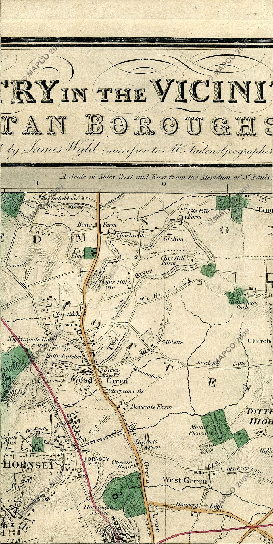
Ducketts Green is a different place to Ducketts Common. It's east of Green Lanes, north of West Green Road and west of Belmont Rd.
It's been that name for a long time, this is a map from 1872.
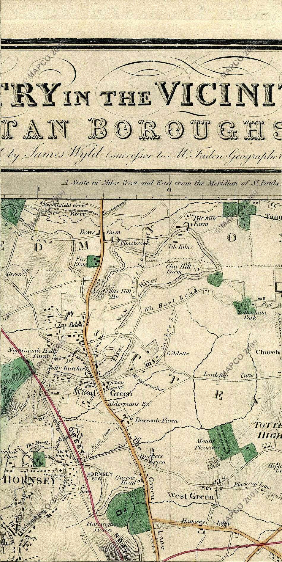
It's also a convenient description for that area which didn't really have a name otherwise.
-
-
Its not different, Andrew. The 'Greens' seem to have been used to cover multiple areas of open land within a certain area. Look at Beans Green on the 1818 Tottenham Parish map above, for example. It is likely that Wyld used 'Duckett's Green' as a convenient label for a recent housing development. Good for him for recognising it, but remember, he was a commercial mapper without intimate knowledge of many of the areas he was mapping. Whilst he was a respected mapper and a member of the Geographical Society, he wasn't beyond reproach and even printed maps of the London rail network which included stations and connections that were planned but subsequently not built.
-
-
Historically it may have been the same but it certainly isn't in current usage. I first came across it with the group Ducketts Green Healthy Streets and have noticed it more since.
-
-
Yes, you're right about current usage. I've explained the origin of its revival above.
- ‹ Previous
- 1
- 2
- Next ›
© 2026 Created by Hugh.
Powered by
![]()