Harringay, Haringey - So Good they Spelt it Twice!
1619 Tottenham map (full)
This is the high res version of the 'Dorset' map of Tottenham available in the Wikipedia entry on Tottenham (here: http://en.wikipedia.org/wiki/Tottenham). What is interesting about it is that it includes (in the top right corner - it is oriented with south at the top) the old shape of St. Ann's Road ('Chisley Lane'), the rough location of Chestnuts Park ('Hangers Greene') and the area of the Gardens Streets is marked as 'Lands belonging to St Iohns of Ierusalem'. It also seems to show the course of Stonebridge Brook to the north of St Ann's Road and, worryingly, a pond bang in the middle of the Gardens (where has it gone?)
-
Comment by linka on June 9, 2011 at 12:47
-
got cut off there, I meant 'it's interesting how messy local memories can get'
-
Comment by Hugh on June 9, 2011 at 12:58
-
You've been hard at work.
A couple of comments:
- Hanger Green House is marked on the 1895 map I added (previous page)
- Here are some notes I took from a book by Mrs Couchman. Although published in 1909, it was reminiscing about unspecified times gone by.
-
Comment by StephenBln on June 9, 2011 at 14:07
-
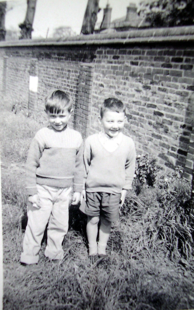
There used to be a stone St John of Jerusalem border sign in our back yard on Warwick Gardens .. Liz checked this out a couple of years ago, but it seems to have gone..
seen in this shot of 1959:
-
-
I found your plaque, or one similar to it. Location shown below.
It looks the same as one on the other side of the wall. That one's a bit clearer, but both seem to mark the extent fo the land owned by the Metropolitan Asylums Board. I can't make anything out about St John of Jerusalem. I found the one on the east side of the wall first which says MAB. I hoped the other might say St John of Jerusalem, but I don't think it ever did.
-
-
Ah, thanks.. I missed this when it was posted. I can only make out Metropolitan ..and .. extends to plinth on other side. So it's refering to the hospital grounds then? Not the Gardens ?
-
-
Yes, it was the Metropolitan Asylums Board staking our their territory.
Add a Comment
- ‹ Previous
- 1
- 2
- 3
- 4
- Next ›
© 2024 Created by Hugh.
Powered by
![]()
You need to be a member of Harringay online to add comments!
Join Harringay online